
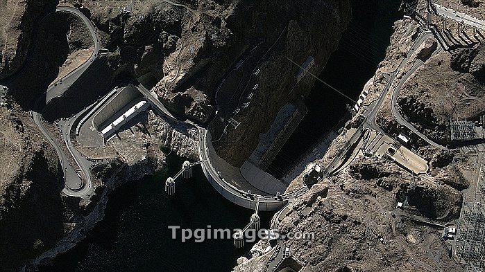
Hoover Dam, GeoEye satellite image. North is at bottom. This dam is located on the Colorado River, USA, with Lake Mead behind it. Below the 221-metre-high dam, the river flows through Black Canyon. The Hoover Dam was built between 1931 and 1936. Large amounts of hydroelectric power are generated at this dam, and pylons and power station equipment are at right. Behind the dam are the four penstock towers, used to control the water flow. The road crossing the dam is US Route 93. GeoEye is a US-based company that operates a range of satellites that provide the world's highest resolution commercial satellite images.
| px | px | dpi | = | cm | x | cm | = | MB |
Details
Creative#:
TOP06673389
Source:
達志影像
Authorization Type:
RM
Release Information:
須由TPG 完整授權
Model Release:
NO
Property Release:
NO
Right to Privacy:
No
Same folder images:
 Loading