
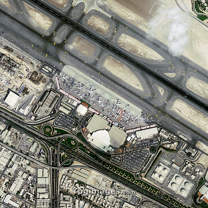
Dubai Airshow, GeoEye-1 satellite image. North is at top. This is the exhibition area of Dubai International Airport during the Dubai Airshow of 2009. This airshow, held every two years, is the leading aerospace event in the Middle East. Hundreds of exhibits and aircraft are seen by tens of thousands over several days. Aeroplanes are at centre, with runways across upper right, and motorways across lower left. Image data obtained on 16 November 2009. The US-operated GeoEye-1 satellite was launched in September 2008, and orbits at a height of 680 kilometres. It is the world's highest resolution commercial Earth-imaging satellite.
| px | px | dpi | = | cm | x | cm | = | MB |
Details
Creative#:
TOP06673386
Source:
達志影像
Authorization Type:
RM
Release Information:
須由TPG 完整授權
Model Release:
NO
Property Release:
NO
Right to Privacy:
No
Same folder images:
 Loading