
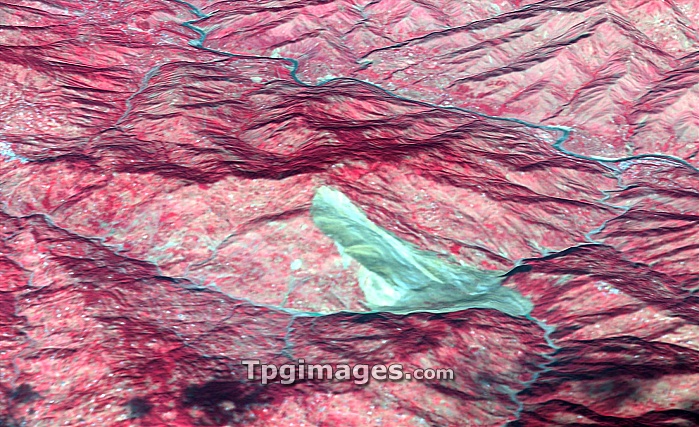
Landslide. Satellite image of a landslide (light blue) in the Pir Punjal mountain range in northern Pakistan. This landslide was triggered by an earthquake in the area on 8th October 2005. This image combines Shuttle Radar Topography Mission data with an image from the Advanced Spaceborne Thermal Emission and Reflection Radiometer (ASTER) on NASA's Terra spacecraft and was taken on 11th October 2005.
| px | px | dpi | = | cm | x | cm | = | MB |
Details
Creative#:
TOP06672479
Source:
達志影像
Authorization Type:
RM
Release Information:
須由TPG 完整授權
Model Release:
NO
Property Release:
NO
Right to Privacy:
No
Same folder images:
landslidemountainasiapakistankashmirpirpunjalmountainsgeographygeologysatelliteimagesatelliteasterterra20thcentury11october2005advancedspacebornethermalemissionandreflectionradiometerasianearthquakefromspacegeographicalgeologicalmountainrangemudslidepakistaniriverriversshuttleradartopographymissiontopographical"
"11200520thadvancedandasiaasianastercenturyearthquakeemissionfromgeographicalgeographygeologicalgeologyimagekashmirlandslidemissionmountainmountainmountainsmudslideoctoberpakistanpakistanipirpunjalradarradiometerrangereflectionriverriverssatellitesatelliteshuttlespacespaceborneterrathermaltopographicaltopography
 Loading