
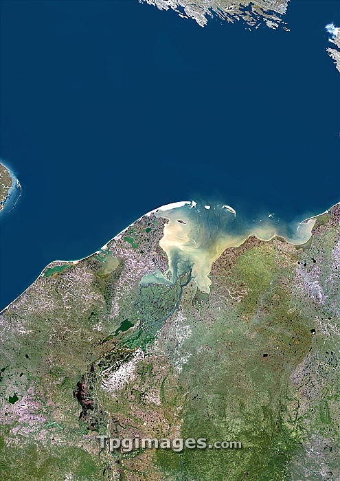
Pechora River Delta, satellite image. This delta is where the Pechora River flows into the Pechora Sea on the north-western coast of Russia. The Pechora Sea is itself part of the Barents Sea, which is part of the Arctic Ocean. The land at top is the southernmost tip of the island of Novaya Zemlya. Composite image obtained using data from the Landsat 5 satellite.
| px | px | dpi | = | cm | x | cm | = | MB |
Details
Creative#:
TOP06672350
Source:
達志影像
Authorization Type:
RM
Release Information:
須由TPG 完整授權
Model Release:
NO
Property Release:
NO
Right to Privacy:
No
Same folder images:
 Loading