
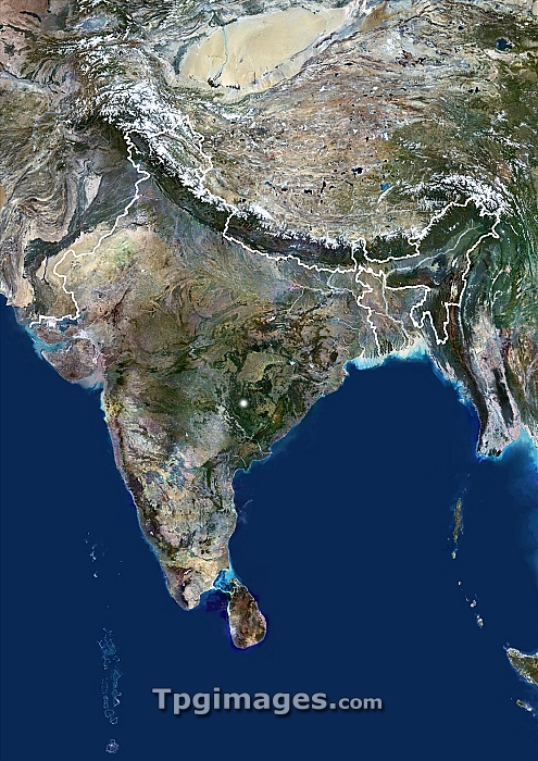
India. Satellite image of India, showing its border in white. North is at top. India is bordered by Pakistan to the north-west and China and Nepal to the north-east. Bangladesh is in the east of the country, entirely surround by India apart from along its coast. The Himalayas are in the North of India. The island off of India's southern tip is Sri Lanka. Composite image from Landsat 5 and 7 satellites.
| px | px | dpi | = | cm | x | cm | = | MB |
Details
Creative#:
TOP06671860
Source:
達志影像
Authorization Type:
RM
Release Information:
須由TPG 完整授權
Model Release:
NO
Property Release:
NO
Right to Privacy:
No
Same folder images:
 Loading