
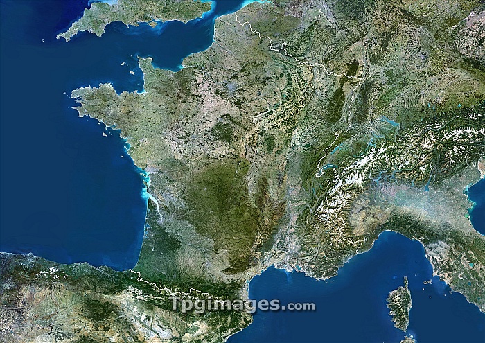
France, satellite image. Its borders are shown in white. Spain is at bottom and England is at top left. The French island of Corsica is at bottom right in the Mediterranean Sea. The Atlantic Ocean is at left. Composite image from Landsat 5 and 7 satellites.
| px | px | dpi | = | cm | x | cm | = | MB |
Details
Creative#:
TOP06671835
Source:
達志影像
Authorization Type:
RM
Release Information:
須由TPG 完整授權
Model Release:
NO
Property Release:
NO
Right to Privacy:
No
Same folder images:
 Loading