
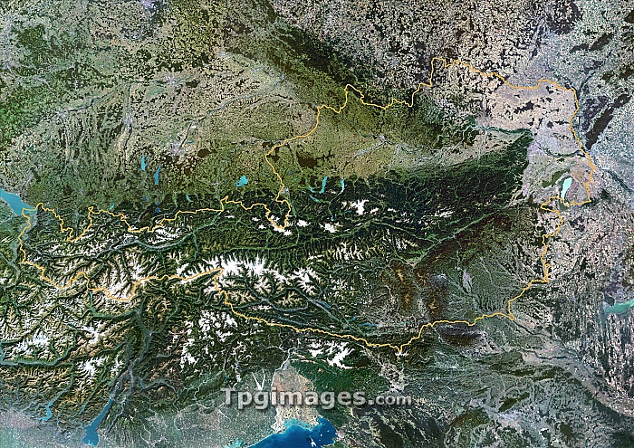
Austria. Satellite image of Austria (border shown in yellow), a landlocked country in central Europe. North is at top. Austria is surrounded by Germany to the north-west, the Czech Republic to the north-east, Slovakia and Hungary to the east, Slovenia to the south-east, Italy to the south-west and Switzerland to the west. The Alps are at lower left. Composite image from Landsat 5 and 7 satellites.
| px | px | dpi | = | cm | x | cm | = | MB |
Details
Creative#:
TOP06671825
Source:
達志影像
Authorization Type:
RM
Release Information:
須由TPG 完整授權
Model Release:
NO
Property Release:
NO
Right to Privacy:
No
Same folder images:
 Loading