
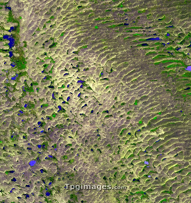
Sand Hills. Satellite image of the Sand Hills region in Nebraska, USA. The Sand Hills, an area of grass-stabilised sand dunes, cover 60,000 square kilometres. The dunes were formed in the Pleistocene Epoch from sediment eroded from the Rocky Mountains by glaciers. Many of the hollows at the bases of the dunes are filled with water (blue). Areas of cultivated vegetation (green) are circular or bound by straight lines. Image taken by the Advanced Spaceborne Thermal Emission and Reflection Radiometer (ASTER) on NASA's Terra satellite on 1st September 2001.
| px | px | dpi | = | cm | x | cm | = | MB |
Details
Creative#:
TOP06670388
Source:
達志影像
Authorization Type:
RM
Release Information:
須由TPG 完整授權
Model Release:
NO
Property Release:
NO
Right to Privacy:
No
Same folder images:
sandhillssanddunenorthamericausanebraskaearthobservationgeographygeologysatelliteimagesatelliteasterterra21stcentury1september2001advancedspacebornethermalemissionandreflectionradiometerancientprairiegrasslandgreatplainsplainunitedstatesamericangeographicalgeologicallakeswaterdunesgrass-stabilisedstabilizeduscultivatedcultivationvegetationhabitat"
"1200121stadvancedamericaamericanancientandastercenturycultivatedcultivationdunedunesearthemissiongeographicalgeographygeologicalgeologygrass-stabilisedgrasslandgreathabitathillsimagelakesnebraskanorthobservationplainplainsprairieradiometerreflectionsandsandsatellitesatelliteseptemberspacebornestabilizedstatesterrathermalunitedususavegetationwater
 Loading