
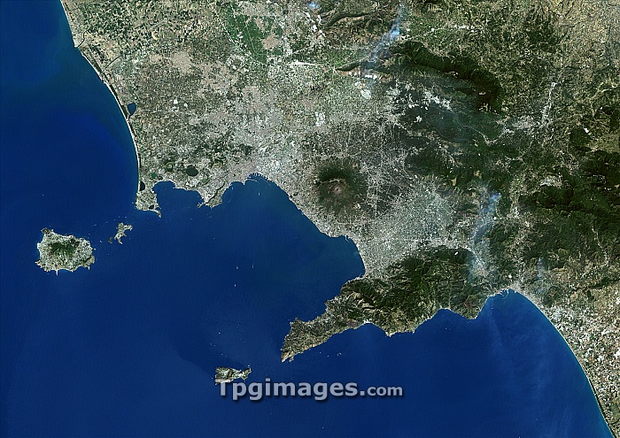
Gulf of Naples, Italy. True colour Landsat satellite image of the Gulf of Naples on the Mediterranean coast of Italy. North is at top. The bay is bordered on the north by the cities of Naples and Pozzuoli (grey, centre), on the east by Mount Vesuvius (round, centre right), and on the south by the Sorrentine Peninsula (bottom right), with its main town Sorrento. Located in the gulf are (clockwise from bottom) the islands of Capri, Ischia and Procida. Image taken on 2nd August 2000.
| px | px | dpi | = | cm | x | cm | = | MB |
Details
Creative#:
TOP06670144
Source:
達志影像
Authorization Type:
RM
Release Information:
須由TPG 完整授權
Model Release:
NO
Property Release:
NO
Right to Privacy:
No
Same folder images:
gulfofnaplesitalyoceanseavolcanocityeuropecoastearthobservationgeographysatelliteimagefromspacesatellitelandsat21stcentury2august2000bayofnaplescapricoastalcoastlineeuropeangeographicalischiaislandislandsitalianmeditteraneanseamountvesuviusnaplespozzuoliprocidasorrentinepeninsulasorrentourbanisationurbanizationvolcanicwatertyrrheniansea"
"2200021staugustbaycapricenturycitycoastcoastalcoastlineeartheuropeeuropeanfromgeographicalgeographygulfimageischiaislandislandsitalianitalylandsatmeditteraneanmountnaplesnaplesnaplesobservationoceanofofpeninsulapozzuoliprocidasatellitesatelliteseaseaseasorrentinesorrentospacetyrrhenianurbanisationurbanizationvesuviusvolcanicvolcanowater
 Loading