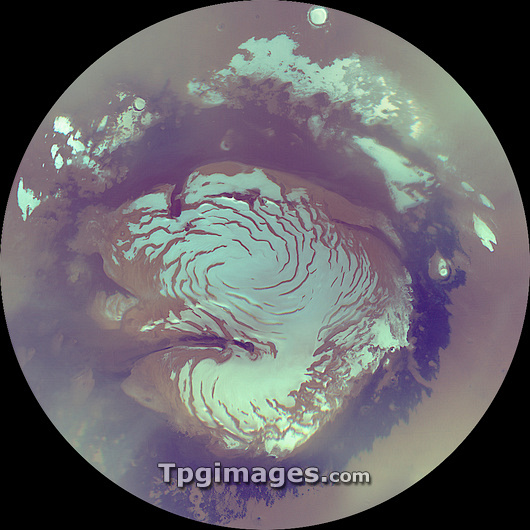
Mars north polar ice cap, Mars Reconnaissance Orbiter (MRO) image. This is a composite of images taken of the region northwards of around 72 degrees north latitude during the Martian summer, when the region experiences perpetual daylight. The polar ice cap (white) is believed to be made of ice and dust deposits and sits on a raised piece of land, Planum Boreum (light brown). A deep trough, Chasma Boreale (purple), cuts into the lower left region of this land. Surrounding Planum Boreum is the sparsely cratered lowlands Vastitas Borealis (purple and light brown). Image taken by NASA's satellite cameras MARCI and MOC on NASA's MRO spacecraft in October 2006.
| px | px | dpi | = | cm | x | cm | = | MB |
Details
Creative#:
TOP03224282
Source:
達志影像
Authorization Type:
RM
Release Information:
須由TPG 完整授權
Model Release:
N/A
Property Release:
N/A
Right to Privacy:
No
Same folder images:

 Loading