
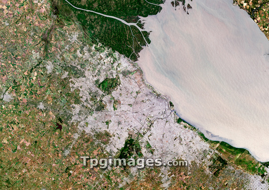
Buenos Aires, Argentina, satellite image. North is at top, urban areas are grey, vegetation is green and agricultural land is brown. Buenos Aires is the capital city of Argentina, located on the bank of the Rio de la Plata (River Plate). To the north of the city is the mouth of the river Parama, which flows into the Rio de la Plata estaury, the large pale brown area stretching to the northeast of the city. The Rio de la Plata flows into the South Atlantic Ocean. Photographed on 20th December 2000.
| px | px | dpi | = | cm | x | cm | = | MB |
Details
Creative#:
TOP03209503
Source:
達志影像
Authorization Type:
RM
Release Information:
須由TPG 完整授權
Model Release:
N/A
Property Release:
N/A
Right to Privacy:
No
Same folder images:
 Loading