
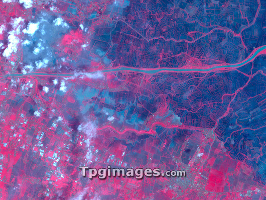
Lusi mud volcano eruption. Satellite image showing the site of the mud volcano in Sidoarjo, East Java, Indonesia. North is at top. In this infrared image, the black areas are bare ground, the water of the Porong River (horizontal strip) appears grey and vegetation appears red. A patch north of the river at top left (also grey, partially obscured by cloud), has experienced continuous mud flow from a vent since late May 2006. This release of built-up mud and gas is thought to have been triggered by oil and gas drilling, but the drilling company blames an earthquake in the region two days beforehand. Photographed by the Advanced Spaceborne Thermal Emission and Reflection Radiometer (ASTER) on NASA's Terra satellite on 10th February 2007.
| px | px | dpi | = | cm | x | cm | = | MB |
Details
Creative#:
TOP03208479
Source:
達志影像
Authorization Type:
RM
Release Information:
須由TPG 完整授權
Model Release:
N/A
Property Release:
N/A
Right to Privacy:
No
Same folder images:
 Loading