
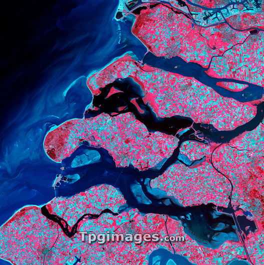
Rhine-Meuse delta, satellite image. North is at top. Vegetation is red, barren areas are light blue, and water is dark blue. This delta has been formed by sediments from the Meuse and Rhine rivers as they flow into the North Sea on the coast of the Netherlands. Most of the land here is covered with fields, with barren fields in blue and growing crops in red. Barriers are seen across the exits of the delta, holding back the tides and protecting this low-lying area. The bright light blue area at upper right is part of the port of Rotterdam. The area shown in this image is around 60 kilometres wide. The image data includes infrared wavelengths, and was obtained on 24 September 2002, using the ASTER sensor on the Terra satellite.
| px | px | dpi | = | cm | x | cm | = | MB |
Details
Creative#:
TOP03208430
Source:
達志影像
Authorization Type:
RM
Release Information:
須由TPG 完整授權
Model Release:
N/A
Property Release:
N/A
Right to Privacy:
No
Same folder images:
 Loading