
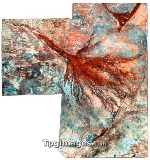
Okavango delta. Coloured LANDSAT satellite image of the Okavango delta, Botswana. This is a mosaic of three images. North is at top. Photographed in the infrared range, dark red reveals vegetation. At top left is the Okavango river which rises in Angola and flows south east to form this delta. The river divides into numerous outlets, fanning out to create a freshwater swamp some 225 kilo- metres long. This delta in north western Botswana is home to a rich diversity of plants and animals. The swamp fluctuates in size with seasonal rain- fall, surrounded by semi-desert. South (at lower right) is the long and black Lake Ngami.
| px | px | dpi | = | cm | x | cm | = | MB |
Details
Creative#:
TOP03208421
Source:
達志影像
Authorization Type:
RM
Release Information:
須由TPG 完整授權
Model Release:
N/A
Property Release:
N/A
Right to Privacy:
No
Same folder images:
 Loading