
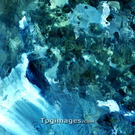
Volcanic landscape, satellite image. North is at top. Desert sands and salt deposits are white, with the colour varying to light blue depending on the amount of rock content. Non-sandy, rocky areas are dark green. This is an area in northern Chile, in the foothills of the Andes, near the border with Argentina. The mountainous desert landscape includes steep-sided volcanic cones (one at upper right). Several of the volcanoes in this region are active. The area shown in this image is around 60 kilometres wide. The image data includes infrared wavelengths, and was obtained on 1 February 2002, using the ASTER sensor on the Terra satellite.
| px | px | dpi | = | cm | x | cm | = | MB |
Details
Creative#:
TOP03207440
Source:
達志影像
Authorization Type:
RM
Release Information:
須由TPG 完整授權
Model Release:
N/A
Property Release:
N/A
Right to Privacy:
No
Same folder images:
 Loading