
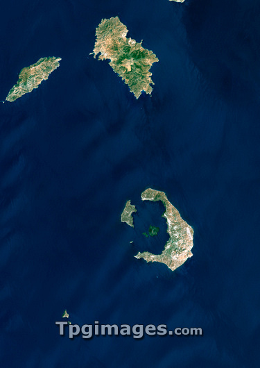
Santorini volcano, Greece, satellite image. North is at top. The sea-filled caldera (lower right) shows where a massive volcanic eruption some 3500 years ago destroyed most of the island of Santorini (also called Thera). The island is part of the Cyclades archipelago, south-east of the Greek mainland. The caldera is about 12 kilometres long. Image data obtained on 8 August 1999.
| px | px | dpi | = | cm | x | cm | = | MB |
Details
Creative#:
TOP03207434
Source:
達志影像
Authorization Type:
RM
Release Information:
須由TPG 完整授權
Model Release:
N/A
Property Release:
N/A
Right to Privacy:
No
Same folder images:
 Loading