
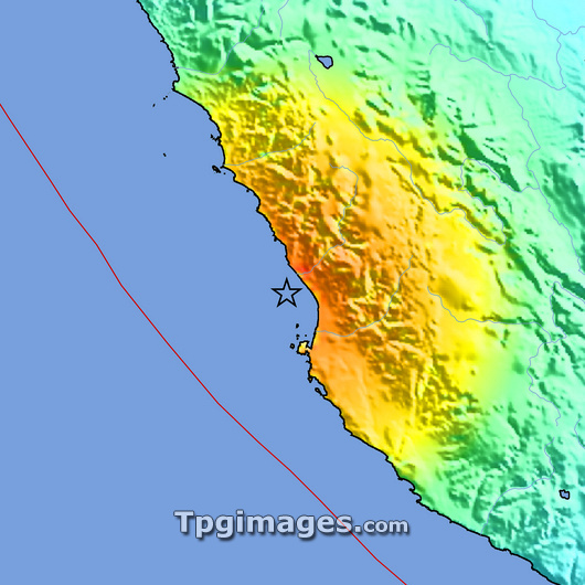
2007 Peru earthquake intensity map. This earthquake struck at 11:40pm GMT on 15th August 2007 and had a magnitude of 7.9. The earthquake killed over 300 people and left more than 800 injured. The epicentre (marked by the black star) was 47 kilometres below the seabed. The colours on the land show the intensity of the shaking felt, from orange (severe) through yellow (strong) and green (moderate) to blue (weak). The red line at left is the fault line between the Nazca and South American tectonic plates. Lima, Peru's capital, is on the coast at the upper border of the yellow and orange areas.
| px | px | dpi | = | cm | x | cm | = | MB |
Details
Creative#:
TOP03207378
Source:
達志影像
Authorization Type:
RM
Release Information:
須由TPG 完整授權
Model Release:
N/A
Property Release:
N/A
Right to Privacy:
No
Same folder images:
 Loading