
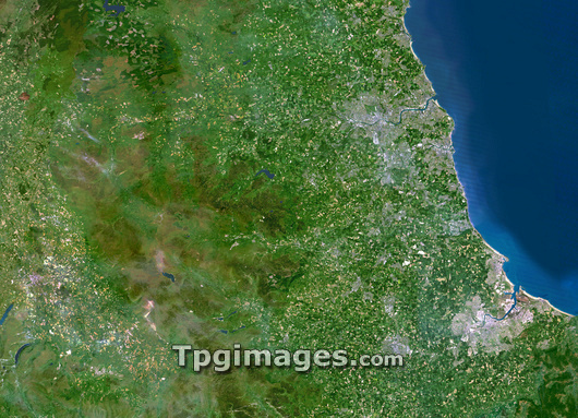
County Durham, UK, satellite image. Vegetation is green, water is blue and urban areas are grey. North is at top. County Durham is a county in north-east England. In the west of the county are the Pennines, a mountain range, and to the east lies the North Sea. The county's coastline is more densely populated than its interior, with several large former coal-mining towns. The river to the north of the image is the River Wear, with the city Sunderland at its mouth. The river to the south is the River Tees. The county's capital, Durham, lies slightly inland between the two rivers.
| px | px | dpi | = | cm | x | cm | = | MB |
Details
Creative#:
TOP03206540
Source:
達志影像
Authorization Type:
RM
Release Information:
須由TPG 完整授權
Model Release:
N/A
Property Release:
N/A
Right to Privacy:
No
Same folder images:
 Loading