
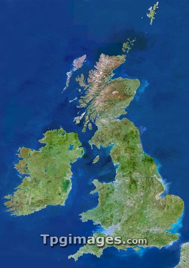
British Isles, satellite image. North is at top. Green areas are vegetated. Brown areas are mountainous. Grey areas are urban. The capital city of the United Kingdom, London, is visible in the southeast. England is largely lowland areas stretching north to Scotland and the Scottish Highlands (brown area). Ireland is the large island to the west across the Irish Sea. In the centre of the country's east coast is Dublin, the Republic of Ireland's capital city. The British Isles border the North Sea to the east, the English Channel to the south and the Atlantic Ocean to the west and north.
| px | px | dpi | = | cm | x | cm | = | MB |
Details
Creative#:
TOP03206538
Source:
達志影像
Authorization Type:
RM
Release Information:
須由TPG 完整授權
Model Release:
N/A
Property Release:
N/A
Right to Privacy:
No
Same folder images:
 Loading