
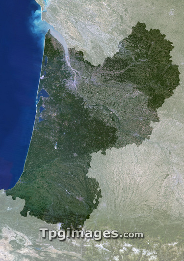
Aquitaine region, France, satellite image. North is at top. Vegetation is shown in green, water in blue, and urban areas in grey. Aquitaine (highlighted) is an administrative region in south-western France which borders with Spain in the south. The Atlantic Ocean lies to the west. The region has a population of around 3.1 million (2005). Its capital is Bordeaux, which lies at the confluence of two rivers in the north of the region. The Dordogne, flowing from the east, and the Garonne, from the south-east, meet and form the vast Gironde estuary.
| px | px | dpi | = | cm | x | cm | = | MB |
Details
Creative#:
TOP03206532
Source:
達志影像
Authorization Type:
RM
Release Information:
須由TPG 完整授權
Model Release:
N/A
Property Release:
N/A
Right to Privacy:
No
Same folder images:
 Loading