
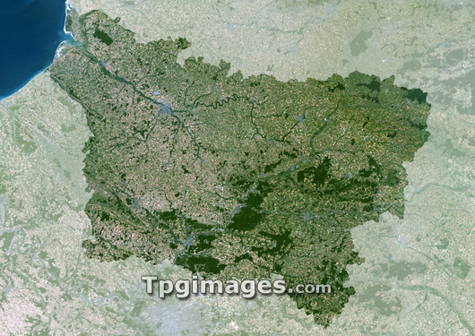
Picardie region, France, satellite image. North is at top. Vegetation is shown in green, water in blue, and urban areas in grey. Picardie (highlighted) is an administrative region in the north of France. Its north-eastern tip borders Belgium; to the west lies the English Channel. The region has a population of around 2 million. Its capital is Amiens, which lies just towards the north- west of the region on the river Somme.
| px | px | dpi | = | cm | x | cm | = | MB |
Details
Creative#:
TOP03206513
Source:
達志影像
Authorization Type:
RM
Release Information:
須由TPG 完整授權
Model Release:
N/A
Property Release:
N/A
Right to Privacy:
No
Same folder images:
 Loading