
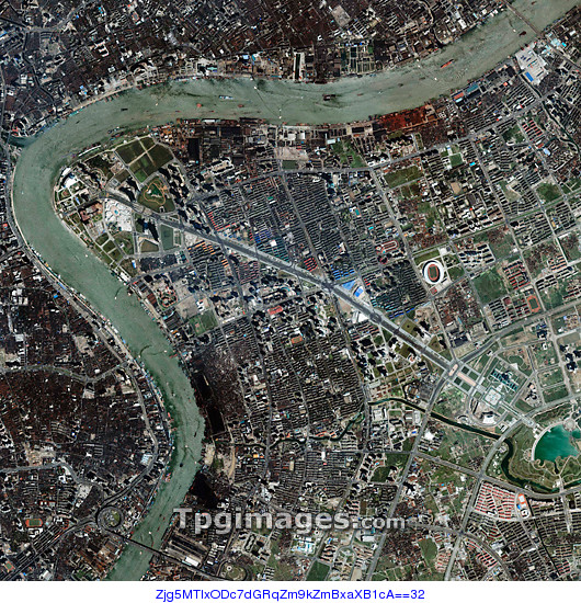
Pudong district, Shanghai, China, satellite image. Shanghai's Pudong district covers the land between the east bank of the Huangpu river (right) and the East China Sea. It was formerly dominated by farms and marshland. In the 1990s it was declared a Special Economic Development Zone and saw huge investment and development. It is now the most modern and westernised part of the city. The tip of the peninsula at top left is home to several skyscrapers and Pudong has become the financial centre of China. Central Pudong is also home to Zhangjiang Hi-tech Park, a 17 square kilometre area for technology orientated businesses. Taken by the Ikonos satellite on 6 November 2000.
| px | px | dpi | = | cm | x | cm | = | MB |
Details
Creative#:
TOP01491331
Source:
達志影像
Authorization Type:
RM
Release Information:
須由TPG 完整授權
Model Release:
N/A
Property Release:
N/A
Right to Privacy:
No
Same folder images:
 Loading